The Biodiversity Mapping in South-west BC: Solutions Workshop was organised by;


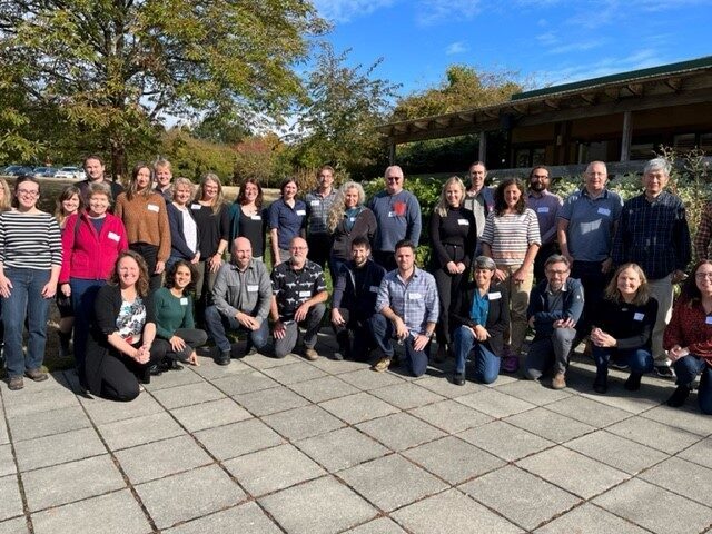
The CDFCP in partnership with UBC Botanical Gardens held a Biodiversity Mapping Solutions Workshop in October 2022. This brought together spatial mappers and users from a broad range of backgrounds including; local, provincial and federal government, First Nations, academics, consultants and eNGOs.
The objectives of the workshop were to:
- Present a summary of project results to date.
- Share and learn about other relevant mapping projects.
- Brainstorm collectively on ideas for developing a preferred set of layers for a Biodiversity Atlas, inter terms of future direction, shared and individual action.
- Build relationships and meet other people who are doing similar work.
- Identify experts to work together on resolving the gaps or problems.
- Define tangible next steps towards building a biodiversity atlas for the study area.
This webpage has been prepared to enable attendees and others to access information generated before, during and after the workshop.
Biodiversity Mapping in Southwest British Columbia: Solutions Workshop Report
This report sets the context for the UBC Botanical Gardens and CDFCP Mapping Workshop, provides a summary of the presentations delivered during the workshop and recommendations received during breakout and group discussions. The appendices for this report are presented below.
Appendix A
CDFCP Nature Smart Project, UBC Botanical Gardens Climate Adaptation Project and the Biodiversity Atlas Project
These three documents provide an overview of the work being undertaken by the CDFCP Nature Smart Project funded by the federal government, the UBC Botanical Botanical Gardens Climate Adaptation Project which is funded by a private donor and demonstrate the mutual objectives of the two projects.
Appendix B
Pre-workshop Questionnaire Results
The first stage of this project was to undertake interviews with mapping experts and users. The interviewees highlighted potential gaps and solutions and the purpose of the questionnaire was to identify areas of consensus.
Appendix C
Mapping Tools Recommended by Workshop Participants
Workshop participants were asked if they could share information relating to mapping tools that they find particularly useful in their work and information on to tools that they may have recently been working on.
Appendix D
Workshop Agenda and List of Participants
These documents present the format of the workshop and the participants who attended on the day.
Appendix E
Presentation Slides
Setting the Context
Mapping Land Cover and Vegetation Structure
Nicholas Coop provides an overview of the tools that can be used for land cover mapping, including the use of satellite imagery and LiDAR. He provides an example of how Metro Vancouver approached this problem, discussed the role of LiDAR in determining stored carbon and how land cover change could be mapped and tracked.
Note: there are periods of poor sound quality in this recording when the speaker steps away from the microphone.
Climate and Ecological Mapping for Forest Adaptation to Climate Change
Tongli Wang presents his work on climate, ecosystem and species mapping. He demonstrates the results of the Flying BEC 2.0 model and discusses the work currently being undertaken to enable ecosystems that currently appear as novel (unknown) ecosystems to be mapped by looking at the habitats present in the same climatic conditions in the US.
Note: there are periods of poor sound quality in this recording when the speaker steps away from the microphone.
Provincial Terrestrial Ecosystem Mapping Initiatives
Note: there are periods of poor sound quality in this recording when the speak steps away from the microphone.
Predicting the Distribution and Abundance of Culturally Important Plants
Climate Adaptive Planning CAP-BC
Peter Arcese provides an introduction to a tool that UBC developed with UNBC that enables decision makers to upload their own mapping layers and they identify their own values e.g. protect 30% of stored carbon in BC. The value of the tool comes when a decision maker has to balance a number of values e.g. biodiversity, cultural values, carbon etc.
Appendix F
Breakout Group Instructions and Prompts
To guide the conversations undertaken by each of the breakout groups each group was provided with information setting the scene and then a series of questions to prompt discussion.
Appendix G
Illustrations of Types of Mapping
This document was prepared for the afternoon breakout session as the mapping currently available in BC is extensive. It should be noted that this document was not prepared with the intent of presenting all available biodiversity mapping and modelling.
Appendix H
Ecological Connectivity Examples
This document was prepared for the afternoon breakout session to provide examples of how municipalities and local governments have undertaken ecosystem connectivity mapping.
Appendix I
Inventory of Spatial Layers Identified during In-depth Interviews
The purpose of the project is to identify the layers currently available and to see if there are any gaps in the information in relation to decision making undertaken by local governments and First Nations and to consider how those gaps could be filled in partnership with the specialists currently managing these tools.
Appendix J
Glossary of Terms
The workshop purposefully aimed to bring together people with a broad range of backgrounds. Therefore, a glossary of terms was produced to enable all attendees to be able to take as much as possible for the workshop and supporting material.
Appendix K
Break-out and Group Discussion
The report provides a summary of the comments provided during the breakout and group discussions. Appendix K presents all points raised during the discussions.
The workshop was funded by;


