CDFCP Conservation Strategy - Goal 1
GOAL 1: CDFAE values (including species and ecosystems at risk) are incorporated into local & regional planning processes, and integrated into nature-based solutions for climate change mitigation and adaptation.
OBJECTIVE 1 . 1 : Collaborate with governments, First Nations and ENGOs to develop plans, policies, bylaws and incentives that recognize and enhance CDFAE values, and to integrate these values into nature-based solutions for mitigating climate change and climate change risk, with a focus on private and First Nations lands.
OBJECTIVE 1 . 2 : Provide education and outreach support to local governments and First Nations working to incorporate CDFAE values and nature-based climate solutions into their planning processes.
OBJECTIVE 1 . 3 : Keep up-to-date with mapping and modelling initiatives relevant to the CDFCP area and capitalize on opportunities to share, collaborate and improve/extend decision-support tools.

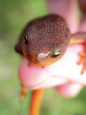
Photo by Adam Taylor
Local Conservation Funds in the CDFCP
To enable the protection of the natural environment local governments can establish Conservation Funds. These are funded through taxes or fees.
An example is the Kootenay Lake Local Conservation Fund. Between 2016 and 2020 the fund accumulated $400,000 that was spent on 29 projects. The Conservation Fund enable the projects to access additional external funding delivering environmental benefits to the local area that would not have occurred if the Conservation Fund was not in place.
In 2021 the CDFCP contracted Bryn White who previously worked for the South Okanagan Similkameen Conservation Program, and had extensive knowledge of the implementation of Conservation Funds. The focus of the project was to assess opportunities and barriers to the implementation of Conservation Funds by local governments within the CDFCP.
As part of the CDFCP project Bryn also providing information to local governments on her experience of implementing these funds.

Ecosystem Mapping Pilot
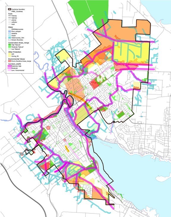
To complement the Conservation Planning in Coastal Douglas-fir Ecosystems Quick Guide for Local Government, the CDFCP has been working on a framework for supporting the incorporation of CDFAE and species and at risk values into local government planning processes. In January 2021, the Cowichan Valley Regional District, Municipality of North Cowichan and City of Courtenay agreed to be the first three local governments to pilot the ecosystem mapping aspects of the framework. All three government are currently undertaking reviews of their Official Community Plans, and the Cowichan Valley Regional District has also started developing a Conservation Strategy.
Allison Haney, a wildlife biologist and GIS specialist with experience developing environmental mapping for local government planning, was contracted by the CDFCP to help produce draft maps for the three local governments, for consideration in their planning processes.

