The purpose of the CDFCP Nature Smart Project is to convene key stakeholders in a cross-disciplinary collaborative process to develop a Framework for the delivery of nature-based solutions to the twin problem of climate change and biodiversity loss in south-west BC.
The focus is on identifying gaps and opportunities in the development of policies, decision-support tools and incentives available to local government, ENGOs and First Nations.
Year 4 Projects - 2024-2025
Survey: Financing Conservation on Private Land in the Capital Region
The purpose of this survey is to gauge the level of community interest for the establishment of a conservation fund that would enable not-for-profit organisations, First Nations and local governments to undertake conservation actions on private property. This funding would assist in supporting community priorities for the maintenance and restoration of forests, wetlands, streams, grasslands and the marine foreshore on private land, thus providing communities with resilience to climate change.
The natural areas in the Capital Region have supported Indigenous Peoples for millennia and remain one of the main reasons people want to live here. However, half of the region is now in private ownership and what happens on these lands has a huge influence on the health of the environment and the well-being of the people who live here.
In the last few years, the region has experienced intense storm events with increasing frequency, leading to flooding, storm surges and power disruptions. High temperatures and extended drought in summers have impacted agriculture, wildlife and people’s health. Tree dieback is visible along roads and in the forest, impacting iconic and culturally significant species such as western redcedar. In 2024, a wildfire started in a regional park near Sooke, resulting in recreation closures, impacts to health due to smoke and posed a threat to clean drinking water. The Canadian Centre for Policy Alternatives (CCPA) found that the damage caused by extreme weather events in BC in 2021 such as heat waves, floods and wildfires cost the province between $10.6 and $17.1 billion. It’s been shown that proactive planning and expenditure in the long run saves money.
The community acknowledged the importance of the natural environment to their well-being when they indicated support for the establishment of a Parks Acquisition Fund in 2000. We are currently exploring the feasibility of establishing a similar fund in the Capital Regional District, only this time focused on private land. These funds could be sourced publicly through the collection of a small tax or levy, which is then distributed annually to local projects through a rigorous application and selection process that ensures the best use of public money to support community priorities. If established, this conservation fund would allow investment in projects that help mitigate climate change impacts, such as restoring riparian areas and wetlands, which pay back over the long term by reducing costs associated with emergency response and recovery from flooding, drought, and fires.
Conservation funds have proven to be successful in several jurisdictions in BC (Columbia Valley, West Kootenay, South Okanagan and North Okanagan), investing in projects that maintain and restore natural areas and the ecosystem services they provide.
A small financial contribution can go a long way. For example, if the approximately 185,000 residential properties in the region contributed $5 a year, it would generate $925,000 that could be invested in conservation projects on private land.
The following survey will help the Coastal Douglas-fir Conservation Partnership (CDFCP) understand the communities’ priorities in relation to the maintenance and restoration of natural areas and how you think these works should be financed. The survey information collected will shared with local government and First Nations elected and hereditary officials in the Capital Region to guide them in their decision making.
Video demonstrating the types of projects that a Local Conservation Fund could contribute to. This video was prepared by the District of Saanich and show cases the work that private landowners, Pennisula Streams Society and the District of Saanich have achieved by working together.
Year 3 Projects - 2023-2024
Sunshine Coast Pilot Mapping: For Conservation and Climate Resilience Planning
KWEST Inc, on behalf of the Action for Adaptation project, mined publicly available spatial data to help overcome mapping limitations including low resolution, incomplete coverage and age of data. The focus was on deriving spatial layers to represent the following themes:
- Potential ecological communities at risk.
- Potential sensitive ecosystems.
- Hydroriparian areas.
- Climate microrefugia.
- Natural range of variability & risk.
- Disturbance (to help update the above layers).
This report contains a literature review rationalizing the derived spatial layers, and a summary of data sources and methods that were used. It also outlines how these features can be used for conservation planning on the Sunshine Coast, with a specific focus on planning climate-resilient green infrastructure and/or conservation networks.
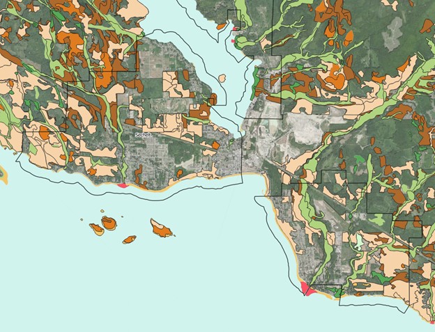
Image taken from KWEST mapping extending the Sensitive Ecosystems Mapping to take account of forest maturing (VRI) and information collected by Terrestrial Ecosystem Mapping.
Incentives for Forest Landowners
In 2023/24 the CDFCP undertook four projects to gain further understanding of the incentives that forest landowners would consider, leading to the protection of nature based solutions to climate change and biodiversity protection. These projects included:
- A Carbon Feasibility Assessment for private forest owners.
- A Carbon Feasibility Assessment for local government.
- Detailed conversations with forest landholders to understand their perspective on carbon offsetting and direct payments for ecosystem services.
- A survey of small private forest landowners to understand their perspective on carbon offsetting and direct payments for ecosystem services.
Photo by Tom Whitfield
Decision Support Tools
The CDFCP is working in Partnership with UBC Botanical Gardens and UBC Okanagan on the development of a Biodiversity Atlas as part of a larger project called Action for Adaptation. The purpose of the Atlas is to provide mapping layers that local governments and First Nations have indicated they need to help guide their planning and decision making to enable the protection of nature based solutions to climate change and the protection of biodiversity. In 2023-2024 the project team had conversations with future Atlas users and reviewed existing decision support tools and mapping layers to determine features that would improve user experience. The information collected is presented in the report series below.
A Review of Decision Support Tools that Protect Nature Based Solutions
The report presents comments shared by users of decision support tools relating to their needs and opportunities. The report also highlights a list of features that decision support tools can include that would improve user experience based on a review of 11 existing tools.
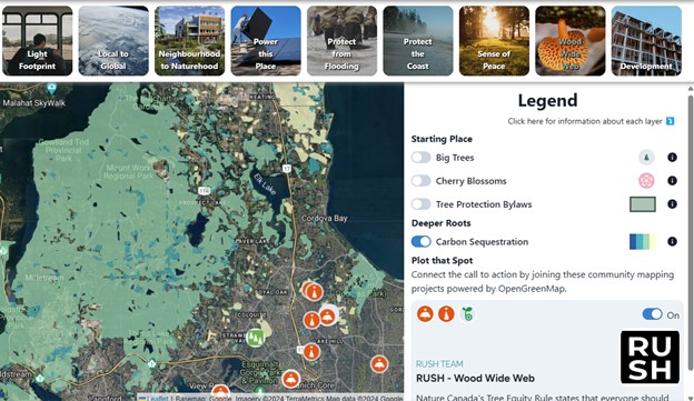
Image: What’s the Rush Initiative
A Review of Mapping Support Tools – Carbon
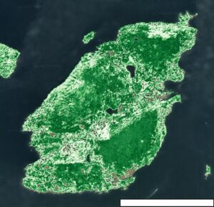
This review highlights the currently available tools that estimate above and below ground carbon storage and existing approaches for mapping carbon sequestration in Canada. The review also highlights how the scale of modelling and mapping (e.g. 10 m vs 250 m) and methods impacts the overall carbon quantification accuracy (e.g. WWF vs Metro Vancouver).
Image: 3GreenTree (now ClimeCo) from CDFCP Carbon Feasibility Report
A Review of Mapping Support Tools – Ecosystem Connectivity
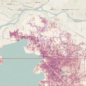
Following conversations with users and by reviewing nine approaches to ecosystem connectivity mapping, this report includes 10 steps that are recommended when approaching this type of mapping by local governments and First Nations. A key part of the process is pulling together multiple pieces of information rather than relying on a single model. Another key element is engaging and working with indigenous and non indigenous knowledge holders.
A Review of Mapping Support Tools – Land Cover
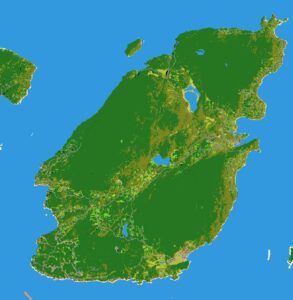
The review looked at nine land cover maps that are relevant to the south west coast of BC. This highlighted how the approach to land cover mapping has a significant impact on its appearance and the ability to replicate it. The report includes recommendations to consider when approaching land cover mapping.
Year 2 Projects - 2022-2023
The CDFCP undertook in depth interviews with local government and First Nations representatives and experts within the field of carbon and environmental finance to:
- Identify gaps or rub points in regulation and policy relating to the protection / creation of ecosystems (forests, fresh water and coastal wetlands) that will reduce or provide resilience to the effects of climate change.
- Review if there is a lack of information / knowledge that is impacting on decision making.
- Identify how financial incentives for private landowners and municipalities could accelerate adaptation.
Below are two reports that have been produced presenting the results. Note that the report presenting First Nations views and comments is not being made publicly available.
Video explaining what we mean by nature based solutions to climate change.
This video was developed by the Nature-based Solutions Initiative at the University of Oxford (www.naturebasedsolutionsinitiative.org). Illustrations by Cécile Girardin and Isabel Key; animation by Matthew Mullholland.
Solutions to Mapping Gaps
The CDFCP undertook a second round of interviews with local government and First Nations planners, provincial and federal government mapping specialists; NGOs; consultants and carbon specialists to explore what had been heard in FY21 and to find solutions to mapping gaps.
Year 1 Projects - 2021-2022
The CDFCP supported the following projects in Year 1;
- Terrestrial Ecosystem Mapping in the Comox Region.
- Carbon Project Feasibility Assessment in the CDFCP Working Area.
- Literature Review of Hydrological Modelling in Relation to Forestry Management.
- Cultural Sensitivity Training for CDFCP Steering Committee members. This was obtained through the San’yas Indigenous Cultural Safety Training Program
Identifying Mapping Gaps
The CDFCP undertook detailed interviews with local government and First Nations planners, provincial and federal government mapping specialists; NGOs consultants and carbon specialists to understand where there were gaps in mapping used to make decisions in relation to the protection of nature based solutions. These interviews are summarized and presented in the report below.
